How to Draw on a Map: Shapes, Areas, and Annotations in the MapGo Workspace
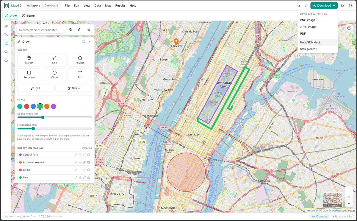
Draw markers, lines, polygons, rectangles, and circles directly on the map in MapGo, then style, rename, move, and manage every shape from one panel.
Learn how to streamline geospatial analysis in minutes, not hours.
And get the latest updates about MapGO's powerful tools
Found 6 articles in New Features
Draw markers, lines, polygons, rectangles, and circles directly on the map in MapGo, then style, rename, move, and manage every shape from one panel.
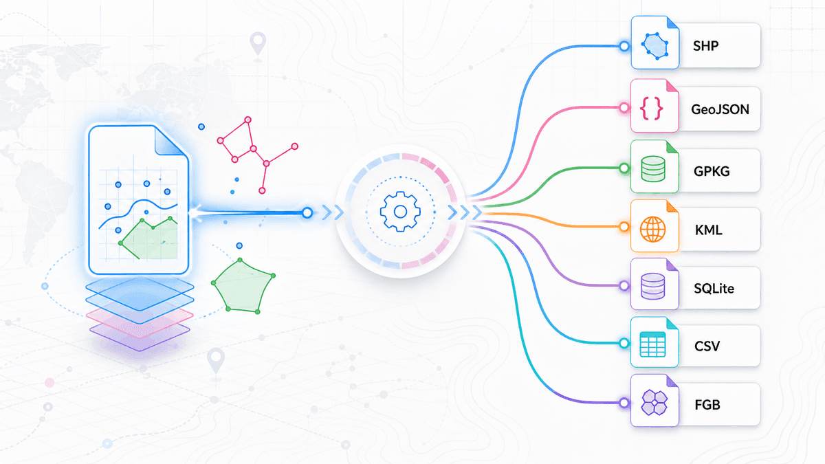
Convert Shapefile, GeoJSON, KML, GeoPackage, SQLite, and other geospatial files online, with optional CRS reprojection.
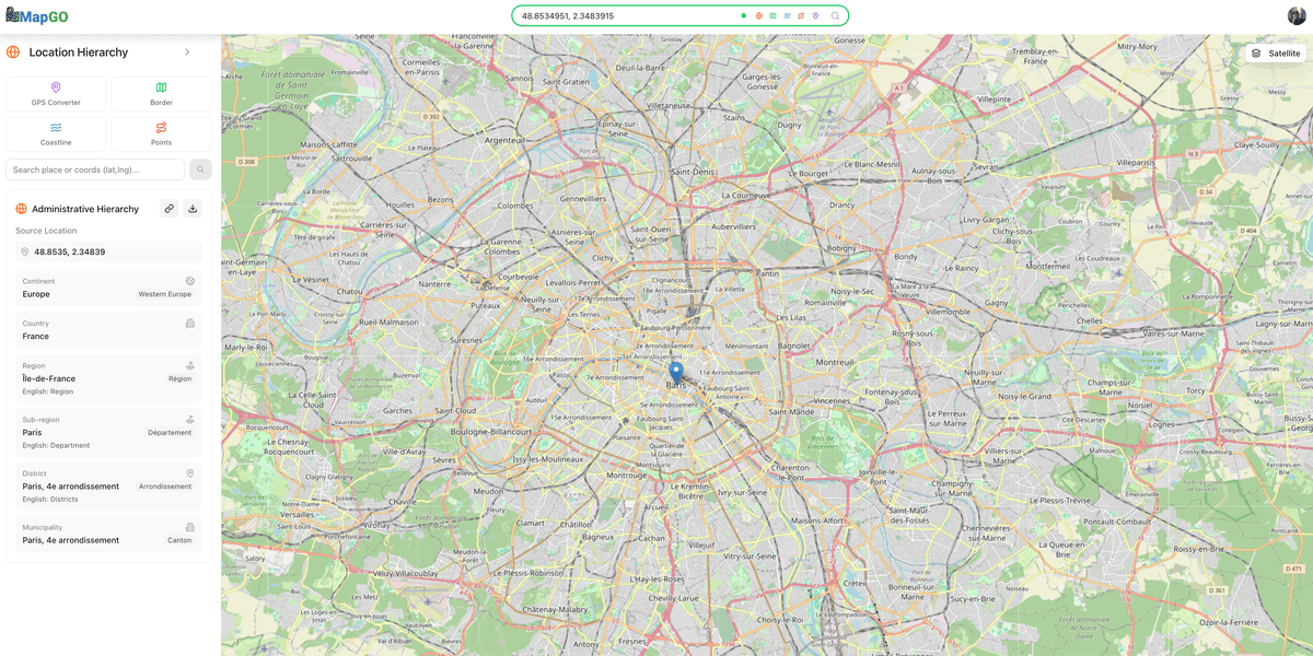
Find the exact administrative area for any coordinate — country, region, sub-region, city, and municipality — with MapGO's Location Hierarchy tool.
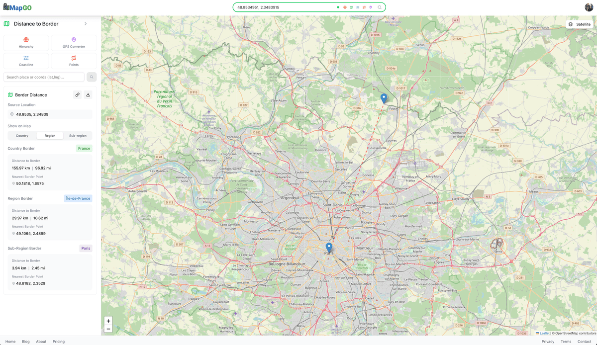
Measure the distance from any coordinate to the nearest country, region, or sub-region border with MapGO's Border Distance tool.
How to use MapGO's Distance to Coastline tool — measure how far any location is from the nearest coast in seconds.
Discover MapGO's 5 core geospatial tools — Location Hierarchy, Distance to Coastline, Distance to Border, Point-to-Point, and GPS Converter.